A Three Degree Upwards Airplane Nose Cruising Angle Cannot Be Used as a Proof For a Flat Earth
NOTE:
The following discussion addresses the idea that airplanes are calibrated to follow the imaginary curvature of the Earth by utilizing such controls and gauges as Elevators, Trim, Nose Angle, Deck Angle, and Barometric Pressure Altimeter readings. Whether aircraft are, indeed, actually calibrated in this fashion is beyond the scope of this discussion. I will only be addressing the mathematical and aerodynamic logic of this Heliocentric claim.
Btw, anyone who knows my work, knows that I am Enclosed Cosmologist. The Earth is Flat with Topological aberrations. Nevertheless, this particular argument does not help advance a proof for a Flat Earth.
People often ask that if The Earth is spherical and the curvature is approximately a 6 foot “drop” for every one mile (i.e., a 6 foot person will disappear over the horizon one mile away), does a jet aircraft need to be constantly adjusted nose down to adjust for the curvature of The Earth? In other words, if a plane was trimmed for straight and level flight, would it “gain altitude” while flying as The Earth surface “fell away” due to the curvature?
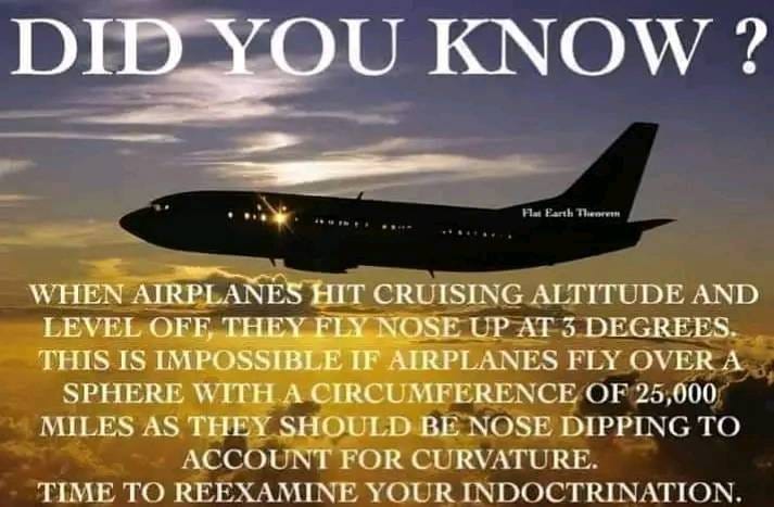
This is The Flat Earth Claim:
Calculating The Drop:
You can use Pythagorean Theorem to calculate Earth’s approximate curvature drop:
1. The sum of the squares of the sides of a right triangle is equal to the square of the hypotenuse.
2. The radius of the Earth is one side of the triangle. (approximately 4000 miles)
3. The distance away from where you are standing is the other side.
4. The hypotenuse tells you how far that point would have to be from the Earth’s imaginary center to stay horizontal from you.
5. Then subtract 4000 from the hypotenuse, and that gives you how far up from the surface that point is, or how much the Earth dropped.
For example, calculate 1 mile out:
1. 4000^2 + 1^2 = 16000001
2. Square root of 16000001 is 4000.000125
3. So, 1 mile out is 4000.000125 miles from the center of the Earth.
4. Subtract 4000, and you get a drop of .000125 miles
5. 5028 feet per mile times .000125 yields about half a foot drop.
Now, the important thing here is that it is NOT linear. The drop isn’t so many feet per mile away. It changes because you are drawing a straight horizontal line, but the Earth allegedly drops as a circle, and so, it won’t be a constant linear feet dropped per mile away.
1. At 1 miles, the drop is 6 foot.
2. At 5 miles, the drop is 15 feet.
3. At 10 miles, the drop is 63 feet.
4. At 15 miles, the drop is 141 feet.
5. And so on and so forth…
More precisely derived:
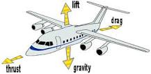
Now, airliners are designed to have an approximately 3-degree nose-up deck angle at cruise altitude, which isn’t really noticeable to most people unless you’re carrying a bubble-level on-board, or staring very intently at your drink, but the exact angle for climb, cruise, and descent will vary depending on the aircraft and how it's been loaded. Nevertheless, you can pretty much descend or ascend with any deck angle you like because different airplane control flaps are responsible for elevation, not the angle of the nose. In other words, you could set the deck angle at 15 degrees if you wanted to so that the nose is pointed upwards at 15 degrees, but the airplane could still rise in elevation because airplane wings are shaped to make air move faster over the top of the wing. When air moves faster, the pressure of the air decreases. So the pressure on the top of the wing is less than the pressure on the bottom of the wing. The difference in pressure creates a force on the wing that lifts the wing up into the air, not the nose angle.
In this example, notice how the nose angle, and/or deck angle position of the F-22 Raptor, does not necessarily always correlate with elevation, cruise direction, or vertical trajectory of the jet:
F-22 Pilot EXPLAINS Raptor Maneuvers:
Deck Angle: DA
Assume you are in a normal airplane in a normal place above the Earth, let's say some nondescript Cessna at 5,000 feet. You are not high enough to see the alleged curvature of the Earth, meaning where the horizon itself is curved, not just looking over the horizon as at a distant mountain or the top of the mast of a sailing vessel coming into port from below the horizon). Ok, now let's say it is a day with more or less good visibility off to the horizon: Visual Meteorological Conditions (VMC). Your wings are level when the port and starboard wings (i.e., this is the left and right wings) are equally spaced with respect to the horizon on either side of the airplane, or other ground reference.
All right now, however, not only can the wings be perceived as level, or otherwise, with respect to the horizon, but also the nose as well. The angle the nose of the aircraft makes with the horizon is the “deck angle,” a somewhat nautical sounding term that simply means the angle the nose makes with the deck, that is, the ground, or perhaps the deck of an aircraft carrier. Nose up is a high deck angle, nose low is a low deck angle, and the actual angle with the deck is the angle itself. Pitch up 30 degrees above the horizon, which may be read directly from the attitude indicator, is a 30 degree deck angle.
Deck Angle and Angle of Attack
Deck Angle also relates to “Angle of Attack”. With the correct power settings, an aircraft can easily descend with the nose up.
In aerodynamics, angle of attack specifies the angle between the chord line of the wing of a fixed-wing aircraft and the vector representing the relative motion between the aircraft and the atmosphere. Since a wing can have twist, a chord line of the whole wing may not be definable, so an alternate reference line is simply defined.
Angle of Attack Awareness in 57 Seconds:
Often, the chord line of the root of the wing is chosen as the reference line. Another choice is to use a horizontal line on the fuselage as the reference line (and also as the longitudinal axis). Some authors do not use an arbitrary chord line but use the zero lift axis where, by definition, zero angle of attack corresponds to zero coefficient of lift.
Elevators
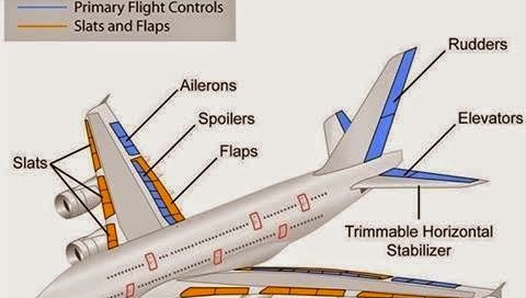
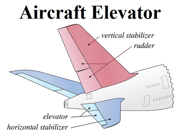
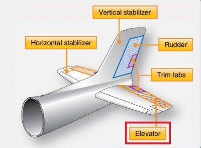
Elevators on an airplane are located on the tail section of the aircraft and are used to control the pitch of the plane, which is the up and down movement of the nose. When the elevators are moved down, they cause the nose of the plane to pitch down and the tail to pitch up. Flaps, on the other hand, are located on the wings of the aircraft and are used to increase the lift of the plane during takeoff and landing. When the flaps are extended, they increase the camber of the wing, which increases the surface area of the wing that is exposed to the airflow. This increase in surface area causes the wing to generate more lift, which allows the plane to take off and land at a slower speed. Because flaps increase lift, they do not cause the nose of the plane to pitch down, as elevators do.
Not really Gravity, of course…again, I am simply giving Heliocentric claims in this discussion:
The best way to think of Elevators and Trim are thus:
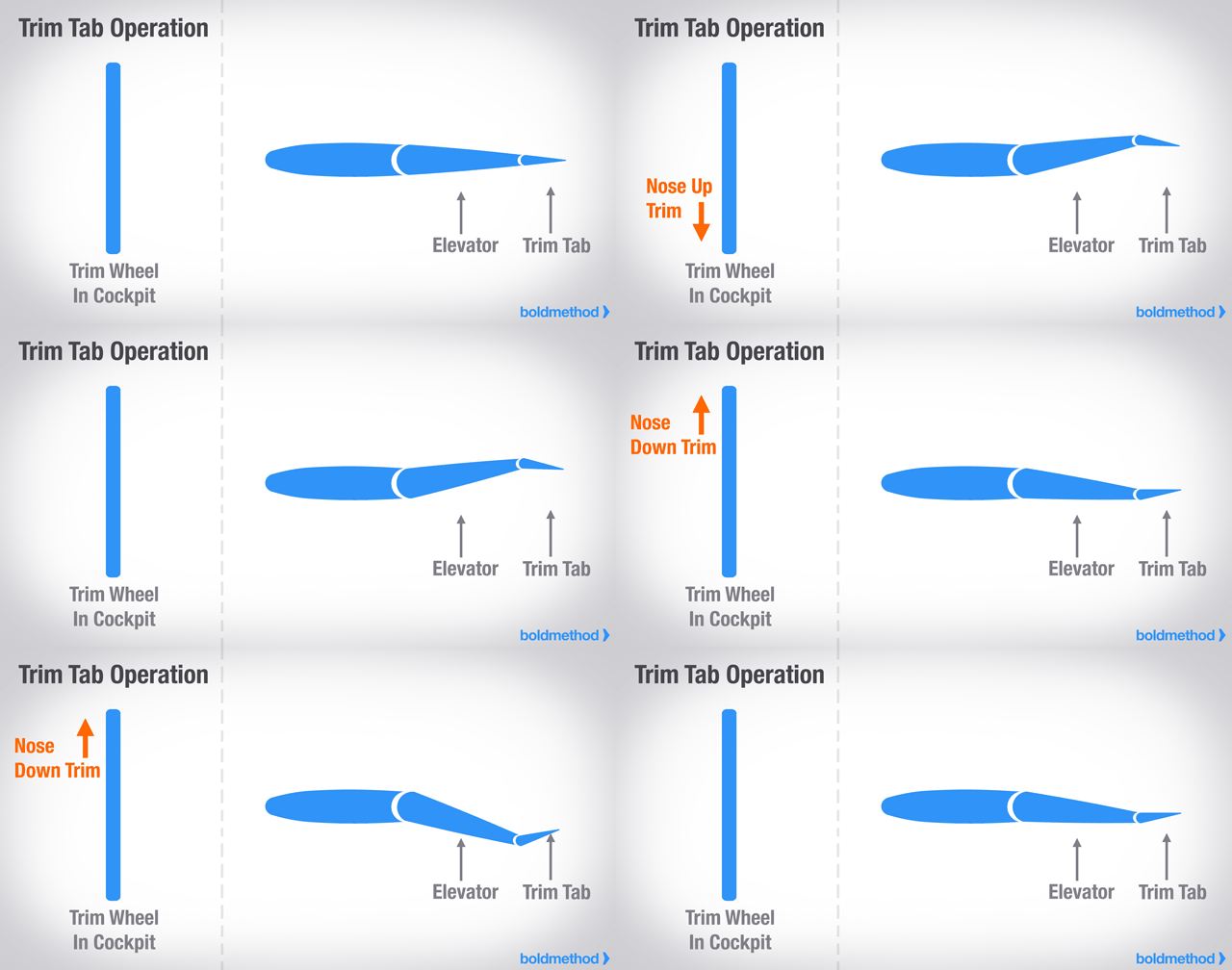
The elevator puts the plane in the attitude you want it in in the sky, and the trim, when properly adjusted, keeps the plane there with no effort on your part. If you find yourself having to push or pull on the yoke in cruise, you are not properly trimmed. Trim Systems are considered to be a "secondary" flight control system. By definition, to "trim" an aircraft is to adjust the aerodynamic forces on the control surfaces so that the aircraft maintains the set attitude without any control input.
Artificial Horizon
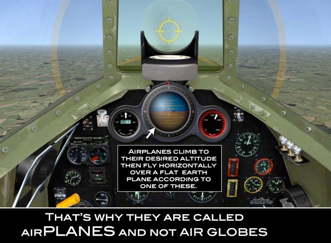
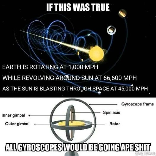
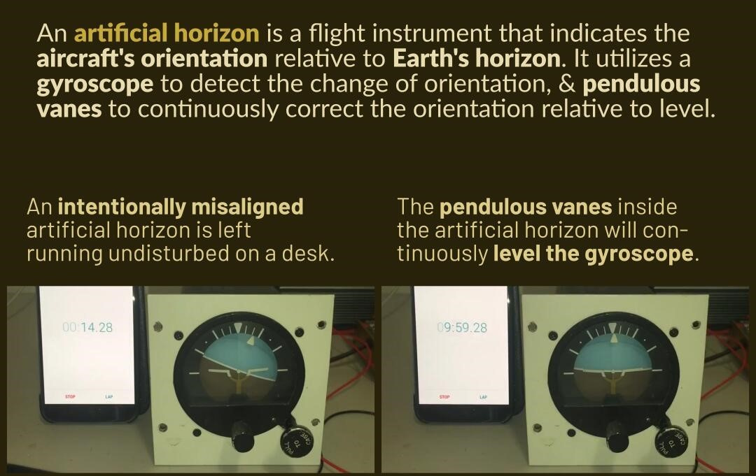
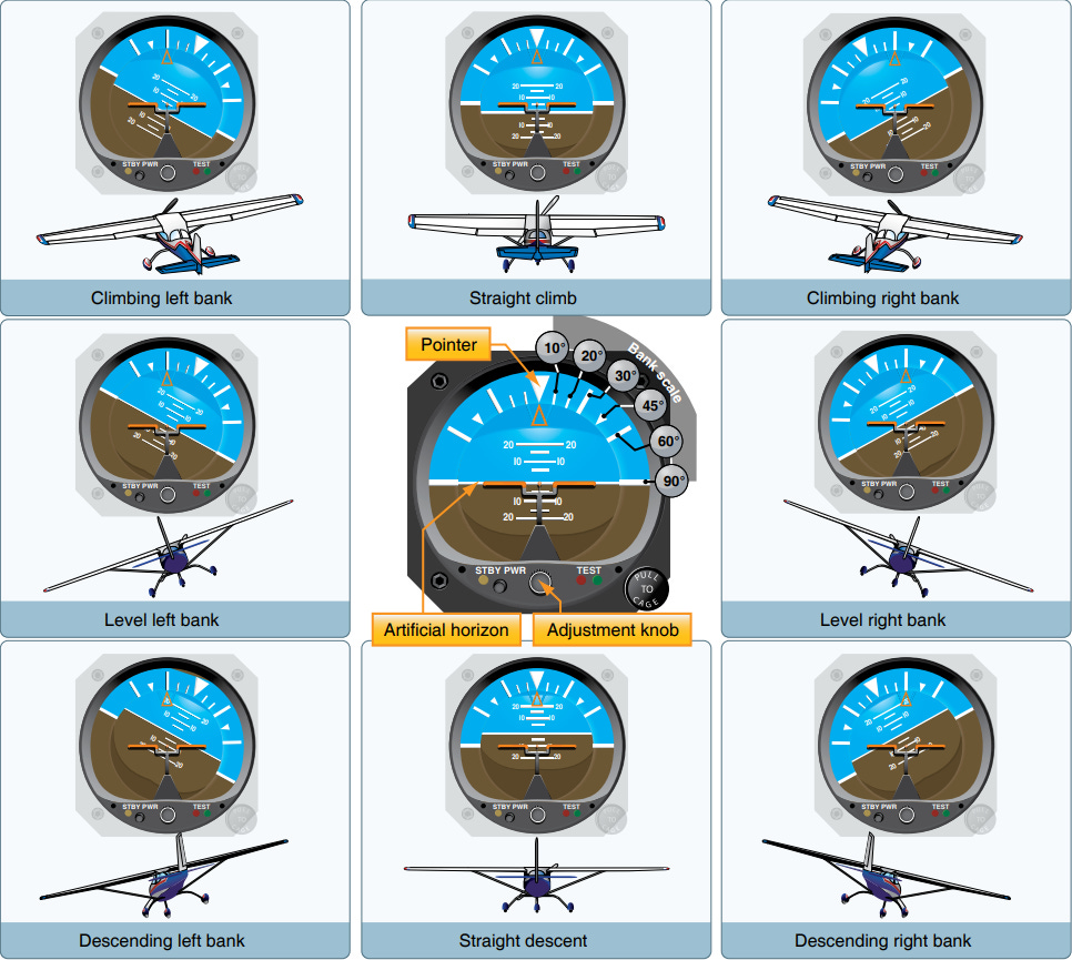
An Artificial Horizon, or Attitude Indicator, is a flight instrument that indicates the aircraft’s orientation relative to Earth’s horizon and gives an immediate indication of the smallest change of orientation. An Artificial Horizon utilizes a gyroscope to detect the change of orientation and Pendulous Vanes to continuously correct the orientation relative to the level.
Attitude Indicator
The Attitude Indicator (AI), formerly known as the gyro horizon or artificial horizon, is a flight instrument that informs the pilot of the aircraft orientation relative to Earth's horizon and gives an immediate indication of the smallest orientation change. The miniature aircraft and horizon bar mimic the relationship of the aircraft relative to the actual horizon. It is a primary instrument for flight in instrument meteorological conditions. Attitude is always presented to users in the unit degrees (°). However, inner workings such as sensors, data and calculations may use a mix of degrees and radians, as scientists and engineers may prefer to work with radians.
Artificial Horizon Vacuum Gyro Erection Mechanism and Pendulous Vanes
Looking inside the Artificial Horizon, we can clearly see the Pendulous Vanes and how they operate. Any time the gyro is not aligned with true level, the Pendulous Vanes will swing slightly to open one airport more than the other. This results in a correcting force that brings the unit back into alignment with true level. The Pendulous Vanes do not care what causes the misalignment, which may be due to precession, harsh maneuvers, or extended periods of turning. They simply act to correct the misalignment. In this way they are constantly correcting the Attitude Indicator to remain level.
NOTE:
It is crucial to note that Artificial Horizon Vacuum Gyro Erection Mechanisms and Pendulous Vanes are not designed to correct for any curvature of The Earth. Rather, they are simply designed to keep an aircraft level.
Flat Earth - A look inside the Artificial Horizon - Pendulous Vanes:
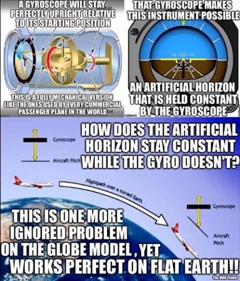
In the following video, a Heliocentrist attempts to explain why The Earth is spherical because of on board Artificial Horizon correction equipment. His claim is that the Artificial Horizon will always correct back to level and that it defines level as perpendicular to down (i.e., the direction objects fall). Additionally, he states that the Artificial Horizon does not remain rigid in space but rather, it is constantly correcting as the gyro moves around the Earth, with this direction of down changing by 1 degree every 111 kilometers. Now, whether his claim that this direction of down is changing by 1 degree every 111 kilometers for all aircraft is the real issue here.
Flat Earthers still don't understand how an Artificial Horizon works:
Pendulous Vanes | Pilot Tutorial:
Barometric Pressure and Pressure Altimeter
Both the devices, an Altimeter and a Barometer, are used to measure pressure. Some Altimeters are Barometric, which means they measure altitude by calculating air pressure of a specific location. Barometers determine the changes in elevation as well as the changes to the air pressure caused by weather patterns.
Barometric pressure and atmospheric pressure is the same because you use a barometer to measure atmospheric pressure. To find the atmospheric pressure with an altimeter, the aircraft must be on the ground, and you must know the elevation of the airport. The altimeter has a rotating knob.
When you turn the knob, two things happen:
1. The altimeter needle moves.
2. The number in the reference window(s) moves.
Now, turn the knob until the altimeter indicates the elevation you are at. Then, read the barometric pressure in the reference window. The scale might be millibar, hectoPascals, or inches of Mercury.
Pressure Altimeter Construction
Barometric Pressure Determination
Now, a plane will fly at a constant altitude and will follow the imaginary curvature of the Earth and will not gain altitude during a level flight. For instance, if a plane is cleared to maintain 35,000 feet, by regulations, the pilot must maintain that level based on a standard barometric pressure setting (29.92 inHg or 1013 millibars) Hence it would stay at that altitude (FL350) because the pilot is either controlling the plane manually or has engaged the autopilot to achieve that.
There are two basic instruments that enable this procedure, an Altimeter and a Vertical Speed Indicator (VSI). The VSI provides short term changes in pressure and indicates whether the plane is climbing or descending. These changes will give an indication to the pilot so that he would level the plane to maintain 35,000 feet. He will adjust the controls very slightly by use of the elevator and trims. This can be performed automatically by the autopilot as well. As such, the flight controls are constantly moving very subtly to maintain the correct attitude.
If a plane was trimmed for a straight and level flight, it would gain altitude while flying as the Earth surface “fell away” due to the curvature of the Earth. Well, that would probably happen in a perfectly motionless atmosphere where the plane would fly dead ahead, and over time gain altitude, provided it has sufficient thrust, as the Earth curves away from under the airplane. By definition, to “trim” an aircraft is to adjust the aerodynamic forces on the control surfaces so that the aircraft maintains the set attitude without any control input. While all axes of rotation are affected by aerodynamic forces, not all aircraft types are capable of being trimmed in all three axes.
In reality, a constant altitude must be kept using the standard pressure and that means a fixed distance to the Earth surface is maintained, making the path of the plane a curved one.
And so, in The Heliocentric Model, a plane is not flying in a straight line, geometrically speaking. It is flying nose up but descending around and over The Earth’s imaginary curvature, while maintaining whatever upwards nose and deck angle that it wants. You can pretty much descend or ascend with any nose and deck angle that you like because different airplane control flaps are responsible for elevation, not the angle of the nose. In other words, you could set the deck angle at 15 degrees if you wanted to so that the nose is pointed upwards at 15 degrees, but the airplane could still rise and fall in elevation because airplane wings are shaped to make air move faster over the top of the wing. When air moves faster, the pressure of the air decreases, and so the pressure on the top of the wing is less than the pressure on the bottom of the wing. The difference in pressure creates a force on the wing that lifts the wing up into the air, not the airplane nose angle.
Again:
In this example, notice how the nose angle, and/or deck angle position of the F-22 Raptor, does not necessarily always correlate with elevation, cruise direction, or vertical trajectory of the jet:
F-22 Pilot EXPLAINS Raptor Maneuvers:













When the pilot is on the ground, setting his altimeter for barometric pressure and the altitude, what reference frame is providing the baseline for altitude or elevation?
Can we say SEA LEVEL?
And the artificial horizon is referencing the horizon… the surface of earth… where the sky and ground appear to converge at eye level.
Down on a sphere is every point on the surface that has a vertical vector pointing to the center of the sphere. If the altimeter were calibrated to follow the “curve” then the zeroing out of the altimeter would have to include the radius of the earth/sphere, not the surface as it’s reference frame.
I agree that this isn’t a solid FE proof. A much better one is to simply cite the dozens of nasa and DOD technical papers on flight that all use the “motionless flat earth assumption.”